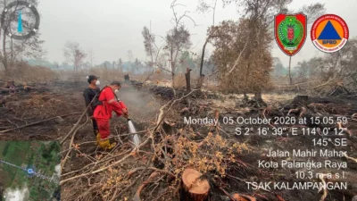


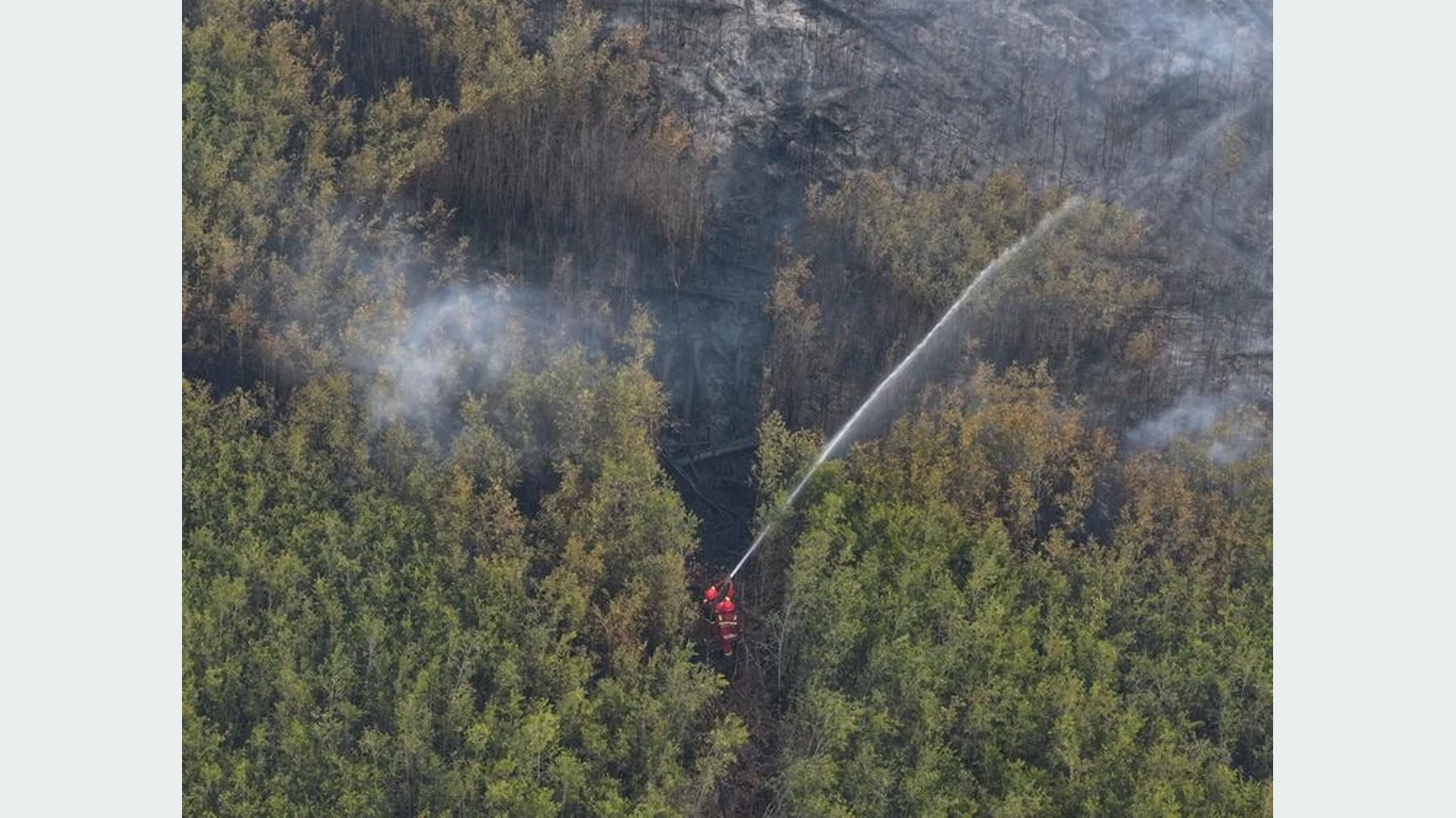
Documentation of forest and land fire control operations. Photo: Ministry of Forestry, October 8, 2026 press release.
PALANGKA RAYA, folitimes.id – High-confidence hotspots in Central Kalimantan increased to 225 in monitoring up to Wednesday (October 7, 2026) at 21:00 Western Indonesia Time. The figure rose from 182 a day earlier, even as the national hotspot total declined.
The differing trends show that national conditions do not necessarily reflect regional threats. Central Kalimantan remains a focus of forest and land fire control operations.
Central Kalimantan Adds 43 Hotspots
The Ministry of Forestry released the latest hotspot figures on Thursday (October 8, 2026).
The Forest and Land Fire Control Early Detection Information System, or SiPongi, recorded 225 high-confidence hotspots in Central Kalimantan.
The same system recorded 182 a day earlier. This represents an increase of 43 hotspots, or approximately 23.6 percent.
The figures show a change in satellite detections during the monitoring period. However, an increase in hotspots does not automatically mean the burned area expanded by the same percentage.
National Total Falls, South Sumatra Surges
Nationally, high-confidence hotspots fell from 1,201 to 1,176.
The decrease amounted to 25 hotspots in one day.
However, South Sumatra recorded a sharp increase, with hotspots rising from 71 to 224.
West Kalimantan increased from 34 to 47. South Kalimantan also rose from 18 to 31.
These changes show that the national decline coincided with increases in several priority regions.
Hotspot Comparison in Priority Regions
| Province | October 6 | October 7 | Change |
|---|---|---|---|
| Central Kalimantan | 182 | 225 | +43 |
| South Sumatra | 71 | 224 | +153 |
| West Kalimantan | 34 | 47 | +13 |
| South Kalimantan | 18 | 31 | +13 |
| Jambi | 21 | 16 | −5 |
| Riau | 0 | 0 | 0 |
| National | 1,201 | 1,176 | −25 |
High-confidence hotspot data from the Ministry of Forestry's SiPongi system. Monitoring period: October 6–7, 2026.
Hotspots Are Not a Fire Count
The Ministry of Forestry stressed that hotspots indicate surface temperature anomalies detected by satellites.
A single fire can generate more than one hotspot. Conversely, not every hotspot proves that an active fire is present.
Therefore, personnel must inspect locations directly before determining conditions on the ground.
This distinction is important to prevent hotspot figures from becoming unverified claims about the number of fires.
Sixty-One Aircraft on Standby
The Ministry of Forestry stated that fire control operations continue to involve multiple institutions.
The government placed 61 aircraft on standby. Seventeen support patrols and weather modification, while 44 conduct water bombing operations.
Air operations work alongside ground firefighting.
However, the national fleet total does not mean that every aircraft is located or operating in Central Kalimantan. Assignments need to be understood through each region's operational reports.
Peat Requires Thorough Cooling
Peat fires present particular challenges.
Embers can persist below the soil surface even when flames are no longer visible above ground.
Personnel therefore need to wet and cool affected areas until they can confirm that locations are safe.
This work requires time, water and repeated monitoring. Extinguishing surface flames alone may not end the fire risk.
Air Quality Remains a Threat
The Ministry of Forestry is also monitoring PM2.5 concentrations in affected regions.
Some parts of Kalimantan continue to show hazardous air quality.
However, the national report does not provide a single PM2.5 figure representative of all Central Kalimantan. Conditions can differ between cities according to fire locations and wind direction.
The government urged people to reduce outdoor activities when air quality deteriorates.
New Data Require a Ground Response
The increase of 43 hotspots in Central Kalimantan is an important development after earlier reports showed fluctuations in detections.
The government needs to explain priority inspection locations, the number of verified fires and firefighting results.
Those data are necessary to establish whether the increase in satellite detections is related to new fires or changes in monitoring.
Reference: Official government statement.